Updated: 2026-07-23 07:28 CEST
Locality
| Locality: |
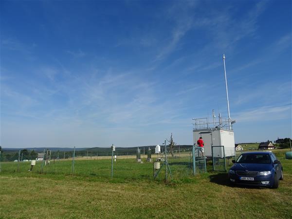
Rudolice v Horach
|
|
| Code: |
URVHA |
| Type of measuring programme: |
Automated measuring program |
| Locality owner: |
Czech Hydrometeorological Institute |
| Abbreviation: |
B/R/N-REG |
| Coordinates: |
50° 34´ 47.402" North latitude 13° 25´ 10.222" East longitude |
| Altitude: |
840 m |
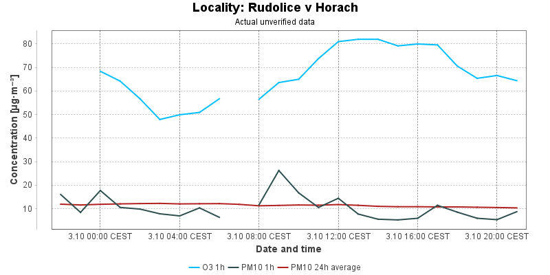
Actual measured level of air pollution
Actual unverified data
| 2026-07-22 07:00 - 08:00 CEST |
|
|
|
|
65.6 |
63.4 |
3.7 |
7.0 |
|
| 2026-07-22 08:00 - 09:00 CEST |
|
|
|
|
65.8 |
63.9 |
11.8 |
7.0 |
|
| 2026-07-22 09:00 - 10:00 CEST |
|
|
|
|
72.0 |
65.1 |
18.2 |
7.5 |
|
| 2026-07-22 10:00 - 11:00 CEST |
|
|
|
|
78.4 |
67.2 |
10.8 |
7.7 |
|
| 2026-07-22 11:00 - 12:00 CEST |
|
|
|
|
80.2 |
69.4 |
7.7 |
7.8 |
|
| 2026-07-22 12:00 - 13:00 CEST |
|
|
|
|
84.6 |
72.0 |
12.4 |
8.1 |
|
| 2026-07-22 13:00 - 14:00 CEST |
|
|
|
|
85.2 |
74.5 |
7.2 |
7.9 |
|
| 2026-07-22 14:00 - 15:00 CEST |
|
|
|
|
83.8 |
76.9 |
17.7 |
7.8 |
|
| 2026-07-22 15:00 - 16:00 CEST |
|
|
|
|
82.8 |
79.1 |
10.7 |
7.8 |
|
| 2026-07-22 16:00 - 17:00 CEST |
|
|
|
|
82.8 |
81.2 |
6.9 |
7.8 |
|
| 2026-07-22 17:00 - 18:00 CEST |
|
|
|
|
82.6 |
82.6 |
3.6 |
7.6 |
|
| 2026-07-22 18:00 - 19:00 CEST |
|
|
|
|
80.2 |
82.8 |
4.2 |
7.6 |
|
| 2026-07-22 19:00 - 20:00 CEST |
|
|
|
|
80.0 |
82.8 |
5.2 |
7.6 |
|
| 2026-07-22 20:00 - 21:00 CEST |
|
|
|
|
76.6 |
81.8 |
5.4 |
7.7 |
|
| 2026-07-22 21:00 - 22:00 CEST |
|
|
|
|
74.4 |
80.4 |
4.9 |
7.8 |
|
| 2026-07-22 22:00 - 23:00 CEST |
|
|
|
|
73.2 |
79.1 |
5.8 |
7.8 |
|
| 2026-07-22 23:00 - 00:00 CEST |
|
|
|
|
|
78.5 |
3.3 |
7.7 |
|
| 2026-07-23 00:00 - 01:00 CEST |
|
|
|
|
71.0 |
76.9 |
3.6 |
7.7 |
|
| 2026-07-23 01:00 - 02:00 CEST |
|
|
|
|
66.4 |
74.5 |
1.0 |
7.6 |
|
| 2026-07-23 02:00 - 03:00 CEST |
|
|
|
|
62.2 |
72.0 |
2.7 |
7.7 |
|
| 2026-07-23 03:00 - 04:00 CEST |
|
|
|
|
56.9 |
68.7 |
1.0 |
7.6 |
|
| 2026-07-23 04:00 - 05:00 CEST |
|
|
|
|
55.1 |
65.6 |
1.0 |
6.9 |
|
| 2026-07-23 05:00 - 06:00 CEST |
|
|
|
|
57.5 |
63.2 |
1.0 |
6.5 |
|
| 2026-07-23 06:00 - 07:00 CEST |
|
|
|
|
63.4 |
61.8 |
1.0 |
6.3 |
|
|
|
Component is not measured |
|
|
Incomplete data |
|
|
Limit exceeded |
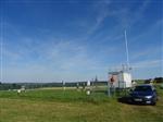
Map of station position
Map is on page with detailed information about locality